 ← Home
02 / The places
Across Romania.
A landscape of places, patterns, and traditions.
Explore regional dress through the illustrations of Alexandrina Enăchescu-Cantemir.
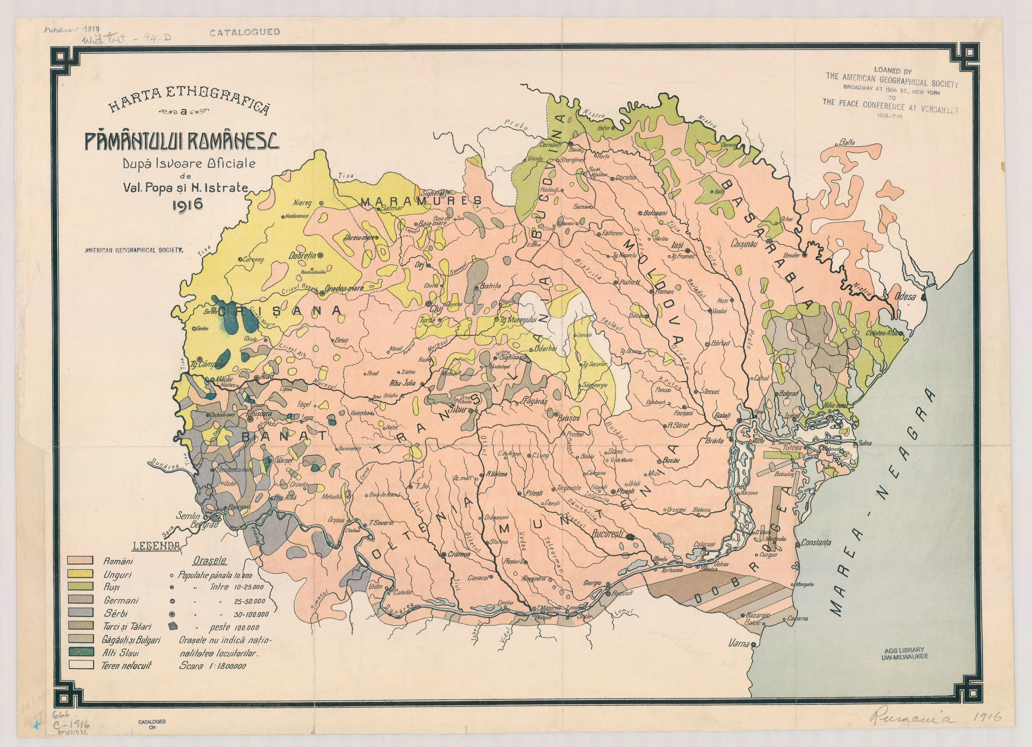
Historical map, 1916 · Colors describe ethnic populations, not costume districts. Labels mark approximate regional locations, not boundaries. On small screens, swipe sideways to explore.
Explore localities and subregions
● Region ■ Subregion · Select a marker or a place name.
From the book
Choose a region
Loading the illustrations…
An artist’s record
Alexandrina Enăchescu-Cantemir
1881–1970
Born in Câmpulung-Muscel, Enăchescu-Cantemir devoted her work to recording Romanian traditional costume. Her careful drawings preserve the forms, colors, and ornament of regional dress.
The illustrations here come from the exhibition’s copy of The Romanian Peasant Dress. Open an illustration to see the full page, including its original multilingual captions.
Read more about the exhibition ↗Reading the map
Places remembered in cloth.
This historical map and the costume book offer two different ways of looking at place. The gallery follows the regional labels recorded for the book illustrations; these do not always correspond to the names or divisions on the map.
Image titles are based on the existing English-caption file labels. Historical spellings are retained where supplied. Wallachia is represented by the map’s Muntenia label; Oltenia has its own gallery. Macedonia and the illustration of Trajan’s Column are grouped under “Beyond the map.”
Map: Val. Popa and N. Istrate, 1916. Image bears the American Geographical Society Library, UW–Milwaukee credit.